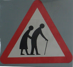
OK, that sounds a bit too melodramatic for a slacker like me. Kim is very ambitious and has done 28 hikes, averaging about 3.5 hours each. He likes to hike uphill, fast, and get a workout. I prefer a pleasant stroll, and nothing too steep.
This was not supposed to be the next blog topic, but since I spent hours yesterday uploading all my hiking photos into a Webshots album, titled Switzerland-Jan’s Hikes, I might as well write about it now!
I already told you about the Mürren to Grütschalp hike, so we’ll start with hike number two, but first, you might want to watch this Youtube video somebody took of the little cog train.
The next hike was a few weeks later, when our daughter Zoe and her husband Jason were visiting. We took the train to Lauterbrunnen again. This is a funny train because the back cars split off along the way and take a left turn to Grindelwald, so you have to make sure you get on a car that is continuing to Lauterbrunnen! That’s not hard though, every car is clearly labelled. Everything here is clearly labelled, especially when it comes to trains.  I love the Lauterbrunnen Valley, but one day I was there at 11am, and it was SO cold. Half the valley was still in shadow. I guess that’s what happens when the cliffs are so high and valley so narrow.
This time, when we got to Lauterbrunnen, we took another train up to Wengen. another car-less ski chalet village, this one about twice the size of Mürren, with a population of 1050, many of whom are celebrities (apparently Robert Redford visits often). It’s also famous for hosting World Cup downhill and slalom races on the Lauberhorn every January. 
Then a cable car up to Männlichen, where we hiked to Kleine Scheidegg, which is a popular ski area right next to the Jungfrau, Monch and the infamous north face of the Eiger.
It’s actually a very easy hike, and there were many families with dogs and small children.  This time the photography was even more out of control as Zoe had a new camera, so between the 2 of us, we slowed a 45 minute hike down to about 2 hours. Oh well, it was gorgeous, and we got lots of nice photos.

When we stepped off the cable car there was a viewing platform with an incredible view of the valley below, but we decided to be good little girls and boys and use the rest rooms first.
 I think these rest rooms were intended for people in formal wear, at least if you go by the signs, but nobody stopped us at the door.
Imagine our dismay when we came out and discovered a cloud had plopped down on us in the meantime and the view was gone!
A lesson learned, never wait to take that photo of the perfect view, it could be gone in an instant!

Never fear, it always seems to clear up magically, and the views just got better and better.
There were only a few places where I had to lean against the uphill side of the path for fear of plunging to my death.
The trail was plenty wide and flat, but I have an irrational fear that I will fly off the path….perhaps it’s not really a fear, but a secret wish to fly. Whatever.

Hike number three was a real hike. Just behind the house there is a large hill named Harder Kulm.
Kim has climbed it many times, and he took Zoe up her first day here, while she still had jet lag.

The elevation gain is about 2,450 feet. Well, I saw an ad for a Nordic Walking class on the Harder, and Kim made the mistake of saying he thought I’d never make it to the top.
That did it, I had to go.
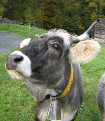
The trail was very steep, but well maintained, still I did get lost a few times, once walking on a gravel road for a while.  Suddenly I arrived at a small bridge and there was the Funicular passing underneath me, and there about 30 feet below me, on a small footbridge, was a couple who were on the real hiking trail. We looked at each other and I shrugged and called out “Um, well it looks like I might have taken a wrong turn?” and the man answered “Just keep going UP, always UP!” It looked like their trail would soon intersect with my road, and just ahead I saw where it did, but then I got distracted by a small farm with cows. I decided to use the video feature on my camera to capture the sound of their bells.

Then I noticed a gate across the road ahead, and a sign that seemed to be saying “Keep Out.” (My German is pathetic) After standing around looking baffled for a few minutes, I saw my fellow hikers emerge from their trail behind me, cross the road, and continue on the trail, which I had missed completely. They explained to me that we had to go around the cows, so now we began hiking together.
Honestly, I don’t know if I would have made it to the top alone. What am I saying, OF COURSE I would! Maybe. Sometime.
While I was hiking alone, I thought of my mother’s advice, as she struggled to convince 3 little girls to walk up a steep hill, to just turn around and walk backwards for a while. It does actually help, because for one thing you are now looking downhill, but also, you use different muscles.
At one point I got hungry and decided to eat my apple; I apologized for eating in front of my new hiking companions, but they had their own apples so it was fine.
Typically klutzy, I dropped mine and it rolled down the trail, then into some grass, and for a moment we all thought it would take off for Interlaken, but it finally came to a stop not too far away, and I retrieved it.
There were some alarming parts of the trail, but the apple drama made me feel a bit safer. 
“After all” I thought, “the apple is completely round, (unlike me, I’m only a little round) and it came to a stop without even grabbing anything, so if I trip and fall, perhaps I will NOT plunge into the abyss?” 
It ended up taking us 2.5 hours to reach the top.
There, as is typical in Switzerland, is a gorgeous viewing platform, clean restrooms, and of course, a lovely restaurant, where I found decaf coffee, and ate a piece of something called Charlotte de Pere. YUM! 
Also typical here is that the funicular runs every 30 minutes. We were a little shocked that it only took 10 minutes to get down! We joked that it should be free for those who hiked UP!
My fourth hike was not really a hike at all, but rather a visit to a previous hike site. The day after we all hiked from Männlichen to Kleine Scheidegg, we woke up to see snow on the mountains.
There was snow all along on the Jungfrau and other high peaks, but now the snow line had moved down. So when my sister Sally was visiting 2 weeks later, we took the cog train from Grindelwald up to Kleine Scheidegg to check it out. Lo and behold, our lovely hiking trail was covered in snow. 
A few days later, on a gorgeous warm sunny day, Sally and I made our way up to Mürren, and then, after a hearty cheesy lunch of Rösti, and Fromage en Croute, we hiked down the road to Gimmelwald, a tiny village that sits on the edge of a cliff overlooking the fabulous Lauterbrunnen Valley. 
This hike was completely downhill, and not too gradual either. For the first time my knees actually hurt the next day.
Near the end of our hike, we encountered a farmer who had a large hose and was spraying what appeared (to all our senses) to be liquified cow poop! We had to step carefully as some had sprayed over the road. 
When we arrived in Gimmelwald there was a nice little cafe, but somehow the ambiance was not encouraging, so we took the next cable car back down to Stechelberg, in the Lauterbrunnen Valley. Down in the valley there was yet another farmer spraying cow poop, so we decided it must have been National Poop Spraying Day.
Did I say down? This cable car ride was VERY steep and thrilling, and on top of that we could see paragliders jumping off the cliffs and sailing down to land right next to the station.
That’s it for my mountain hikes. There have been a lot of hikes through cities, and vineyards too, so stay tuned. 
And don’t forget, there are many more photos of these hikes on Webshots.
Just click on the album titled “Switzerland – Jan’s Hikes.” Hopefully soon we’ll have an album from Kim’s hikes too, because he has some really stunning, perhaps even terrifying pictures!